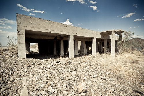
Abandoned Terminal

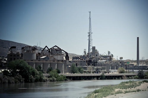
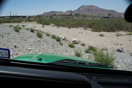
Down by the southern end of Doniphan, there are several old industrial, mixed use lots. A few have buildings and equipment left that are worth checking out:


View Larger Map

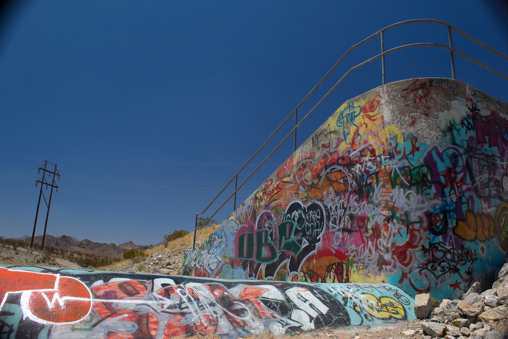
I have been next door in the past and shot some pics of graffiti covering a large grey wall. (Flickr set here:Graffiti) For those shots I used my Holga and now that I have my Rebel T3i I wanted to go back and take them again.  They have since been painted over so I focused my attention on the empty terminal lot:

Terminal Entrance
Terminal Entrance

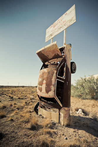
The BNSF train line that runs along Doniphan splits off and travels up to this site so there must have been some loading and unloading going on here in the past.  If a train happened to travel up the tracks now he would meet an old Olds:

End of the Tracks

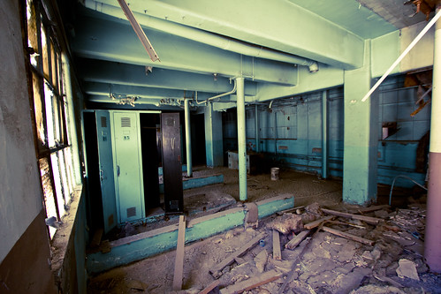
The last resident looks to have been a construction company, and they liked Dr Pepper:

Building
Building Front
Dr Pepper
35¢? I’ll take 3!

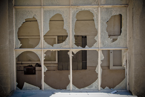
For 35¢ who wouldn’t? I wished it was full and running, the 100 degree heat was pretty unbearable, every surface radiated the high temps right back at you. The Pepper machine has been dragged out into the elements and cracked open but it looks to be intact. Other objects have been exposed for far longer as evident in this electrical panel:

Lights out!
Lights out!

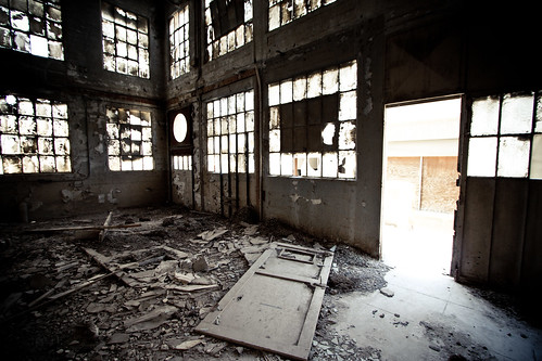
There are other industrial artifacts scattered around the site in the same states of disrepair.  I was short on time to begin with so I exited and headed back to the cool confines of my office. Full Flicker set here: Abandoned Terminal

Fabens, Texas has a big cock!

Well it does:

My, what a big cock you have there

Fabens, Texas is the last stop east out of El Paso county.  The ginormous rooster guarding Fabens Street is not the only interesting item here.  Some of Steve McQueen’s “The Getaway” was filmed there, though off hand I couldn’t pick out where.

Before the rooster is a Pontiac Ventura permanently embedded in an empty lot.  It appears to be advertising the locations great potential for your future business opportunity:

Crash and Burn here!

Traveling down Fabens Street, left onto Alameda and in about a mile you will find what looks like a airplane graveyard:

Final boarding call for the last flight out of Fabens

The property has several fuselages scattered about it along with random airplane parts and crates of Steno cans.  The Steno and plane wrecks gave me a creepy “Alive” vibe, minus the cannibalism and bitter cold.

Fabens is also not immune to the effects of rampant file sharing and movie piracy:

Eddie couldn’t holdout for the return of Betamax

Just down the street from Eddie’s is Hotel California:

Captain, Please bring me my wine

Not really.  It sure does look similar to the Eagles album cover though.  The warm hands of God must have kept their palm trees alive during February’s unusual 4 day freeze, unlike 95% of El Paso.

I didn’t have much more time to keep driving around freaking out the locals so I headed back to EP.  The full Flickr set can be found here: Fabulous Fabens

The Dam Tour

On our way back from a trip to Durango Colorado, we stopped for some lunch at the Elephant Butte Dam in Truth or Consequences, New Mexico.  The Dam water levels are at historic lows:

The Dam top

For comparison here is a pic from its peak, early 90’s:

The Dam from the other side when full

One of the most striking effects of this is how desolate and barren it feels now.  Now, I know its in the middle of a desert but when it was full it was a lot more inviting.  This just felt…hot, like being in a hot tub in summer.

All this exposure though has uncovered some interesting features though, most notably the site of an old hospital:

The hospital ruins

The restaurant at the Dam site has recently been remodeled and they had pretty good food at decent prices.  There is even a patio for chilling with a beer which with all this heat may be the biggest seller.

Dam Restaurant

There are paths that were built before the water was so high so it is easy to get down from the restaurant area but to get to Hospital Canyon we had to drive down some dirt roads, not 4×4 stuff but not your beaten path. A flickr walk through of the area can be found here: Dam!

Southwestern Portland Cement Plant

I went back to the Southwestern Portland Cement Plant today and shot some more pics using a wide angle lens.  For reference here is what the plant looked like in the 1900’s:

Southwestern Portland Cement 1900’s

Here it is from across the Rio Grande today:

Southwestern Portland Cement present day

I have shot a bunch of photos here, the place is really cool.  This section of the plant has been out of use for quite some time and the elements have really done a number on it.  Pigeons, bats and vagrants have been the only residents over the past 30 years and it shows.

Anybody need some bat guano?

There are a ton of places to explore and its fairly safe as long as you watch out for the holes in the floor and the huge killer wasps.  I’ve been here a few times and so far haven’t crossed paths with any wanderers or aliens. When it was easier to cross the river in this area, I’d be willing to wager this was a major stopping ground to stop and rest or change clothes.

The green room

I’m going to come back one more time and go into the main office area but for that one I think i’ll bring somebody with me.  It’s in an upstairs portion and there’s to many dark places for somebody to be hiding out.

All punched out

The previous Flickr sets can be viewed here:

Set One 5/10/2011
Set Two  5/16/2011

I’m on a Bridge to Nowhere

If you have lived in El Paso for a while one of the things you may have noticed on the westside is the bridge to nowhere.  It’s right before the Sunland Park exit and there appears to be no reason for it.

Who put that here?

There was once a purpose but when the drainage dam was built the road to it got severed leaving only the entrance from the neighborhood in Buena Vista.  That side is fenced off.

The bridge taunts you from behind the gate

I have always wondered if it was possible to get to it so today I set off to try. I looked at the area from above on Google and found a dirt road that entered the drainage area from the side of the Westside Recreation Center. There is a gate but today it was open.

Looks all flat and easy from here.

Once in I drove to a wash area where some taggers had hit some concrete walls.

Krylon tracks

From there I drove along the top ridge and then down the side of the dam.  That proved to be a dumb move as once I got to the bottom I was greeted by 3 foot boulders blocking my way. After trying unsuccessfully in 4low to get back up the only way I found around was by skirting the bottom of the dam sideways next to the boulders. It was a long 1o minutes of sideways slip and sliding.

Easy does it

I won’t lie and say I wasn’t sweating bullets.  The rocky substrate kept sending me towards the boulders, I had to fight the urge to gas it and just let myself creep along.  The end of the boulder line drops you right at the entrance to the bridge so all in all it worked out.

Success!

I wasn’t going to be able to go back the way I came so I traveled down a rocky and rutted hill which put me right next to I-10, before the Sunland exit.  For future reference, it may be possible to go this route instead of the tricky way i went.   I think its time to look into winches.

Full Flickr set here: Bridge to Nowhere